BUT Géologie carries out missions of study of rock walls and slopes in order to highlight the possible instabilities, to quantify the risks and to propose ways of correcting them.
BUT Géologie provides technical assistance, management and full control of mining sites, drilling and mining operations according to the most modern methods, techniques and technologies.
We also provide advice and technical support during the opening and operation phases, as well as audits and technical skills.
Our services
With its substantial expertise in geosciences, BUT Géologie provides services in mining and quarries, employing innovative and promising technical and economic methodologies.
Tactical and strategical exploration
- Thematic mapping with GIS for identification of mineral targets in fluvial sediments and soil geochemistry at national or regional level for metallogenic synthesis.
- In this process, reconnaissance, geophysical and geochemical studies are carried out to gather data, which is then correlated and interpreted to make informed decisions.
Pre-feasibility study
- Conduct technical and economic analyses of different operational and processing initiatives.
- Performing an evaluation of the reserves on a local level.
- Assessing the viability of a project from an environmental standpoint, taking into account factors such as hydraulic, hydrogeological, ecological, socioeconomic, and geotechnical considerations.
- Providing accurate estimations of costs.
Regulation of exploration and operating permits, explosive ordnance disposal plans and performance of various types of technical and environmental studies.
- Adhering to local regulations and providing guidance on any regulatory modifications.
- Assisting with exploration and development permits, operating permits, research permits, and operating permit issuance commitments.
- According to Tunisian standards and regulations, we offer methods and plans for exploitation, development, and rehabilitation of various quarry types, including aggregates, sands, gypsum, and granites.
- Assistance in selecting machinery and equipment for quarry operations, including crushing and screening stations and silica sand treatment plants. Selection criteria include the nature of the quarry, geology reserves and promoter requirements.
- Proposal of potential sites for calcium carbonates, siliceous sands, clays, and marble stones resulting from geological field studies.
The process of identifying and evaluating reserves based on the quality of deposits.
- Drilling monitoring, 3D geological modeling, mining geostatistics, resource and reserve valuation, mining projects (3D modeling), mining diagrams, mineral processing – processing diagrams, cost estimation.
- Technical assistance and management of production and drilling operations.
“BUT Géologie” provides you with professionals specialized in the cartography of the ground explored, structural geology, sampling, investigation of useful substances, core drilling and interpretation of reconnaissance drill data (correlations).
Reconnaissance drilling (core drilling) supplements field surveys to better understand subsoil composition.
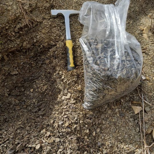
BUT Géologie specializes in the exploration, expansion, and rehabilitation of mines, including quarries and open-pit mines.
- Cartography
- Structural geology
- Sampling works
- Prospecting mining products
Partner with BUT GéologieBUT Géologie BUT Géologie possesses the expertise and technical knowledge to effectively apply various practical applications of hydrology and hydrogeology.
BUT Géologie specializes in studying water catchments and piezometers. Our team is dedicated to developing precise specifications for water well drilling projects. At BUT Géologie, we are passionate about providing top-of-the-line services related to water catchments and piezometers.
Our office oversees the drilling process to optimize structure and equipment based on site observations.
Our team conducts pumping tests, interprets well drawdowns, and undertakes various other tasks:
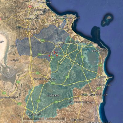
- Prevention zones perimeters calculated for all basin types (wells, drains, sources).
- Determining perimeters can be done by conducting tracing tests that measure transfer rates inside aquifers.
- The task involves identifying the specific properties of underground water reservoirs, such as the type of aquifer and its hydrodynamic parameters, including porosity, permeability, transmissivity, storage coefficient, and other relevant characteristics.
- Estimating the reserves of aquifers…
- Calculating the exploitation rate of a water well…
“BUT Géologie” offers its customers a range of geophysical prospecting solutions.
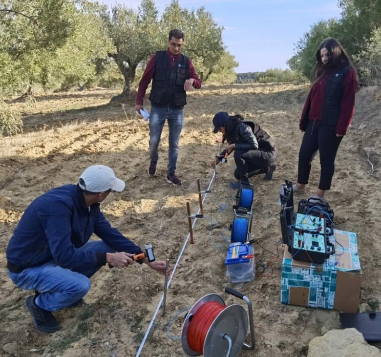
Electrical methods
Electrical methods are mainly based on the distribution of electrical potential in the soil. Measuring the electrical resistivity of the earth produces both quantitative and qualitative results.
The geological interpretation of the results allows a distinction to be drawn between healthy rock masses, weathered areas, waterlogged areas, and natural accidents.
This is custom heading element
Seismic methods are useful in civil engineering and can reveal the thickness of a readily excitable ground or position the roof of a compact bedrock. They also make it possible to highlight de-consolidated or karstified zones within the limestone massif or evaporates.
BUT Géologie conducts impact studies of blasting operations on neighboring villages or other sites to determine appropriate technical and security measures.
This is custom heading element
Le Géoradar is a non-destructive geophysical survey technique based on the analysis of the propagation phenomena (refraction, reflection and diffraction) of high frequency electromagnetic waves.
The use of Georadar is a recent technique associated with instrumental constraints that have been the object of much research in various fields of application: archaeology.
BUT Géologie offers a wide range of expertise and services, as well as a wide range of computing tools in geographic information systems (GIS): ArcGis, Global-Mapper, QGIS, GvSIG, Envi…
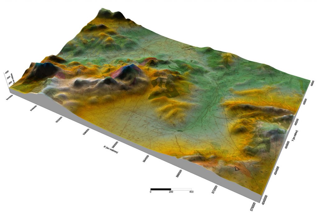
Our experts master a multitude of tools and GIS systems to serve our customers.
We act in a methodical way to update our skills and knowledge by integrating the latest techniques and systems.
- Digitization and vectorization of plans (urban data, geological data, etc.)
- Production of the map base (raster and vector)
- Design and modeling of geographic databases
- Field survey
- Production of cartographic documents and creation of geolocated data.
- Digital cartography
- Digital rendering at different scales
- Georeferencing of maps, plans, satellite images, etc.
- Production of Digital Terrain Models (DTM)
- Thematic cartography
BUT Geologie is involved in the field of environment and nature protection by deeply assimilating the issues of sustainable development and climate change.
Technical assistance and support to industries in environmental projects
- Environmental analysis at several scales of observation at the level of industrial units: cement plants, crushing and screening units…
- Regulations concerning the different types of waste from an industrial activity: industrial waste, liquid waste, atmospheric waste, etc.
- Optimization and valorization of various types of waste…
- Proposal of an innovative environmental strategy.
- Solving environmental problems.
Development and monitoring of Environmental and Social Management Plans (EMP)
Realization of environmental studies for industrial units: cement plants, crushing and screening units...
- Environmental impact studies
- Remediation studies
- Environmental Assessments and Audits
- Environmental notes
- Environmental Assessments
INTERNATIONAL
Ensuring access to our clients and the management and optimization of our professional network have always been top priorities for our engineering office, « BUT Géologie ». Furthermore, we have never wavered in our commitment to expanding our business abroad, particularly in sub-Saharan Africa and the Middle East.


 MINES AND QUARRIES EXPLOITATION
 Section
 GEOTECHNICS
 GEOPHYSICS PROSPECTING SOLUTIONS
 GEOMATICS
 Section